Fire in Moorpark
This fire started near Magic Mountain on Friday afternoon and by Saturday, October 25th,
had burned 25 miles southwest and threatened Moorpark (and Simi Valley). We watched water
drops on hot spots
that popped up west of the freeway. They held the line at the 23 freeway and
watched carefully around the Reagan Library. The final count of losses in Moorpark was
8 homes and 3 accessory structures, along with
approximately 25% of the area within the city limits, around 2000 acres.
The total acreage lost in Ventura County was 115,000 acres.
The 118 freeway was
closed between New LA Avenue and First Street Saturday evening and Sunday because
flames were burning on both sides of it. The 23 was closed for a similar time period, as
well as Tierra Rejada. A later drive along Tierra Rejada revealed burned areas on both
sides of the road, just a long stone's throw from the Reagan Library.
Arroyo Vista Community Park (adjacent to the high school)
was set up as a base camp for the firefighters
working in Ventura County. Schools were closed on Monday, and when they reopened, students
were kept inside to minimize exposure to smoke and ash in the air. Moorpark College
was closed both Monday and Tuesday.
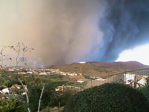
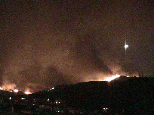
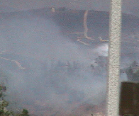
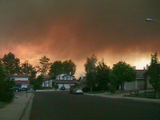
We drove up the Sweitzer's driveway to get a better view. These pictures are taken
from there, looking northeast towards the water tower and the 23 freeway on Saturday
around 5pm.
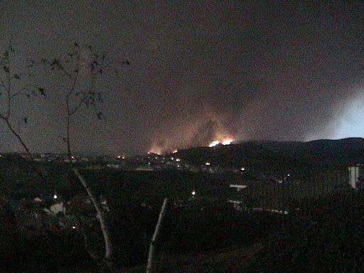
It's not clear just where these flames are; we'll look later.
Later: the flames must have been burning between SDI and the
golf course; the median on the 23 freeway is blackened
by the New LA Avenue exit, and the hills on the east side of the
freeway are all charred.
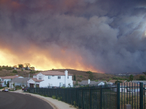
View from the McGreevy's home in Simi, looking west. Thank you for the photo, John.
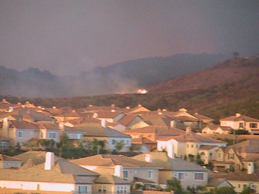
Sunday morning view north from top of hill at Monte Vista Park. Looks like the
area of homes behind the Princeton shopping center is under attack. We also saw
many plumes of smoke all along the railroad tracks, near where the metrolink
trains park, all along Poindexter, and marching west past Gabbert and out
the 118 west of town. Flames were occasionally visible.
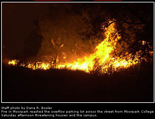
We also have heard that the overflow parking lot for Moorpark College burned last night.
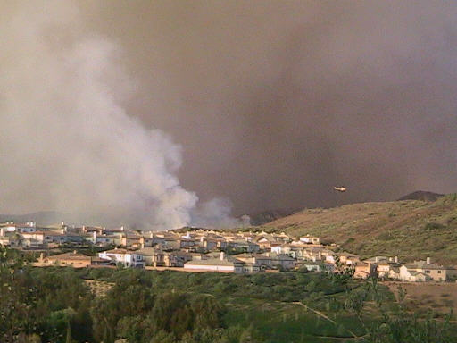
Water drop, as seen looking north from Jennica Wallman's home. They are agressively
dropping water on the fire area that is threatening homes.
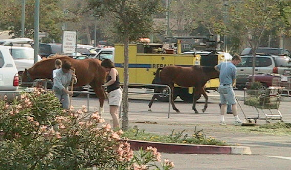
Early afternoon Sunday. These horses in the Vons parking lot
have probably been
evacuated from local ranches.
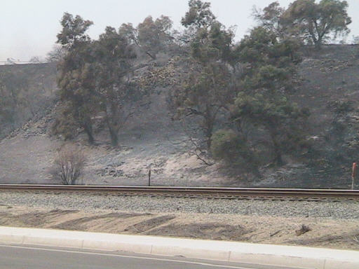
The fire burned through just 300 feet from Glen's office, on the
north side of the railroad tracks and Poindexter Rd.
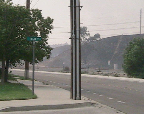
Sunday afternoon: it's still smoldering along Poindexter.
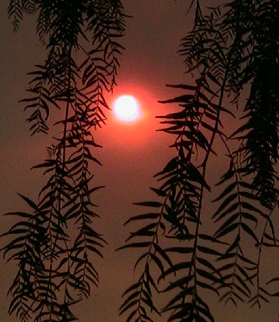
The sun at 3:30pm was so obscured by the smoke that it was
possible to look straight at the orange ball.
Large ash particles were being blown all over.

Around 4:30pm we checked the view from the Sweitzer's driveway
again. This is looking northwest across Peach Hill Park and
our house towards the flames in the hills around Gabbert Rd.
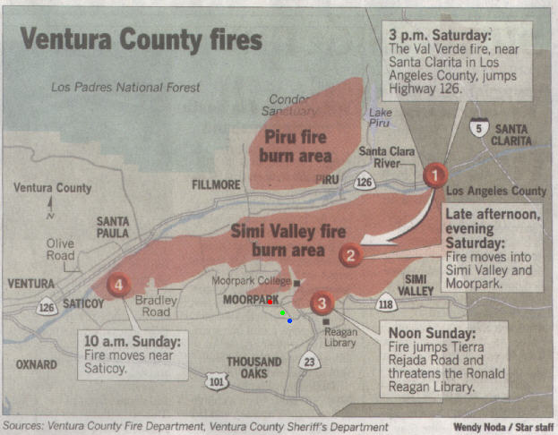
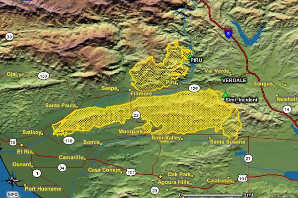
This map was in our paper on Monday morning, by which time it was already out-of-date,
but still interesting. The green dot is the approximate location of our house.
The blue dot is the Sweitzer's, from whose driveway we were watching the fire. And
the red dot is Glen's office, just off Poindexter.
The main concern of the Simi Valley Fire this morning is at the east end of that
city now, at the
Ventura County/LA County boundary.
The fire hopped the 118 freeway around Kuehner and Rocky Peak and now they're
trying to keep it from burning through Box Canyon south to Calabasas and to keep it
from impacting Chatsworth.
Monday night sunset on Honeybee St. Our house is to the
right side.
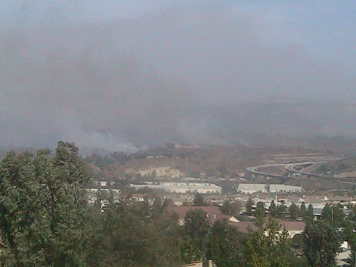
Tuesday afternoon view of the hills by Campus Park homes
in Moorpark. This is across the street and 5 homes away
from our friends, the Meinkes.

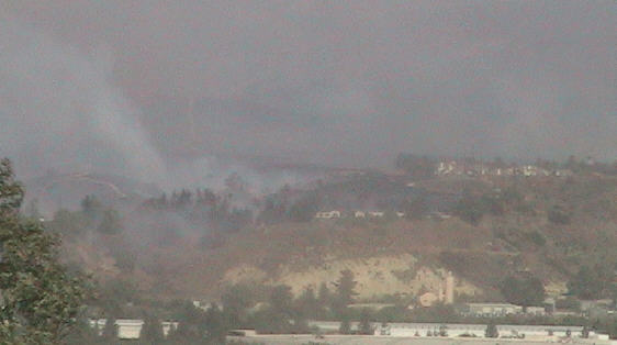
This is one of the homes near the Meinkes, perhaps where they
were helping to clear brush on Sunday.
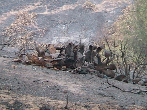
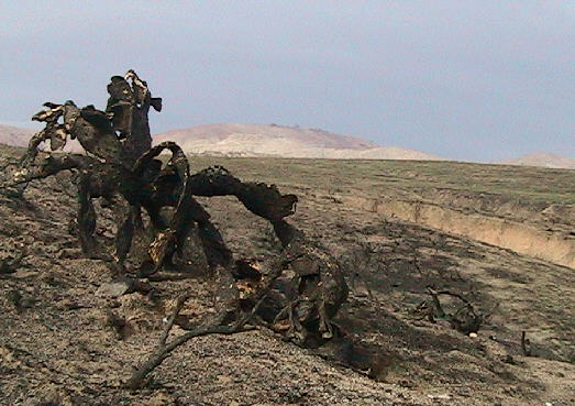
What's left of a clump of cactus. Some firefighters were
reportedly injured by such cactus.

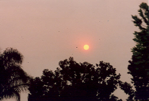
The smoke clouds were just thick enough to permit naked-eye
viewing of the sun around 4pm. We could even see a couple of larger
sunspots.
This map comes from venturacountystar.com on Wednesday morning.
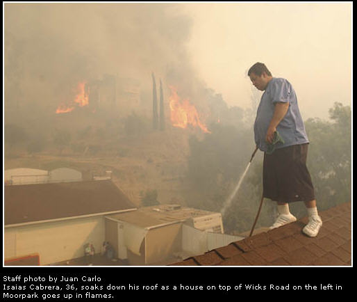
I borrowed this image from our online newspaper, www.venturacountystar.com.
Wicks Rd is just north of and parallel to High St.
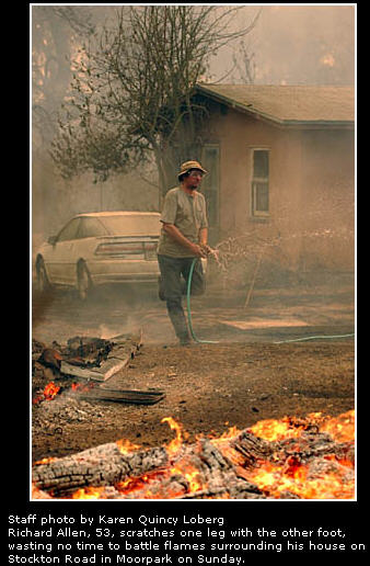
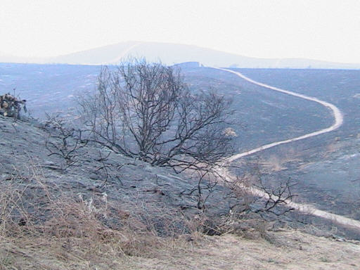
Another borrowed image. Stockton Rd. winds through the hills
northwest of Moorpark.


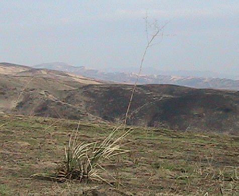
The following pictures were taken on January 1st, mostly at Happy Camp.
Green grass is already sprouting up, rejuvenating the land.
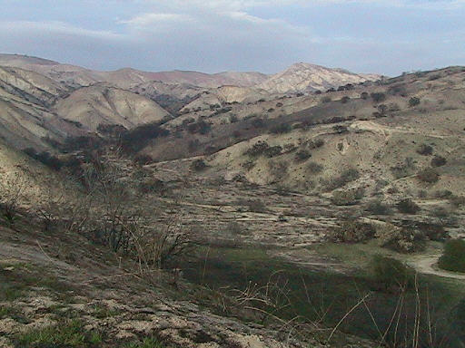
You can see the structure and color of the hills.
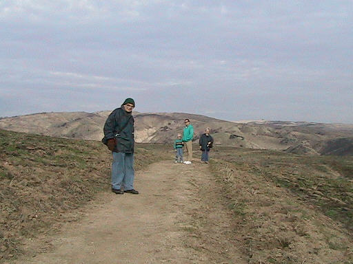
We hiked in from the parking area off Broadway.
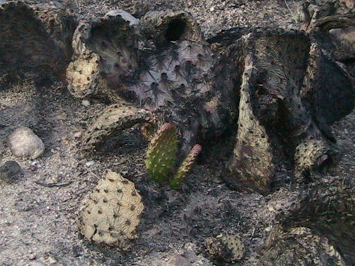
New cactus shoots are appearing.

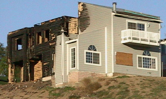
This house on Wicks Rd is one of the few homes that
were lost in Ventura County.
Return to Album Index
Return to Fall 2003